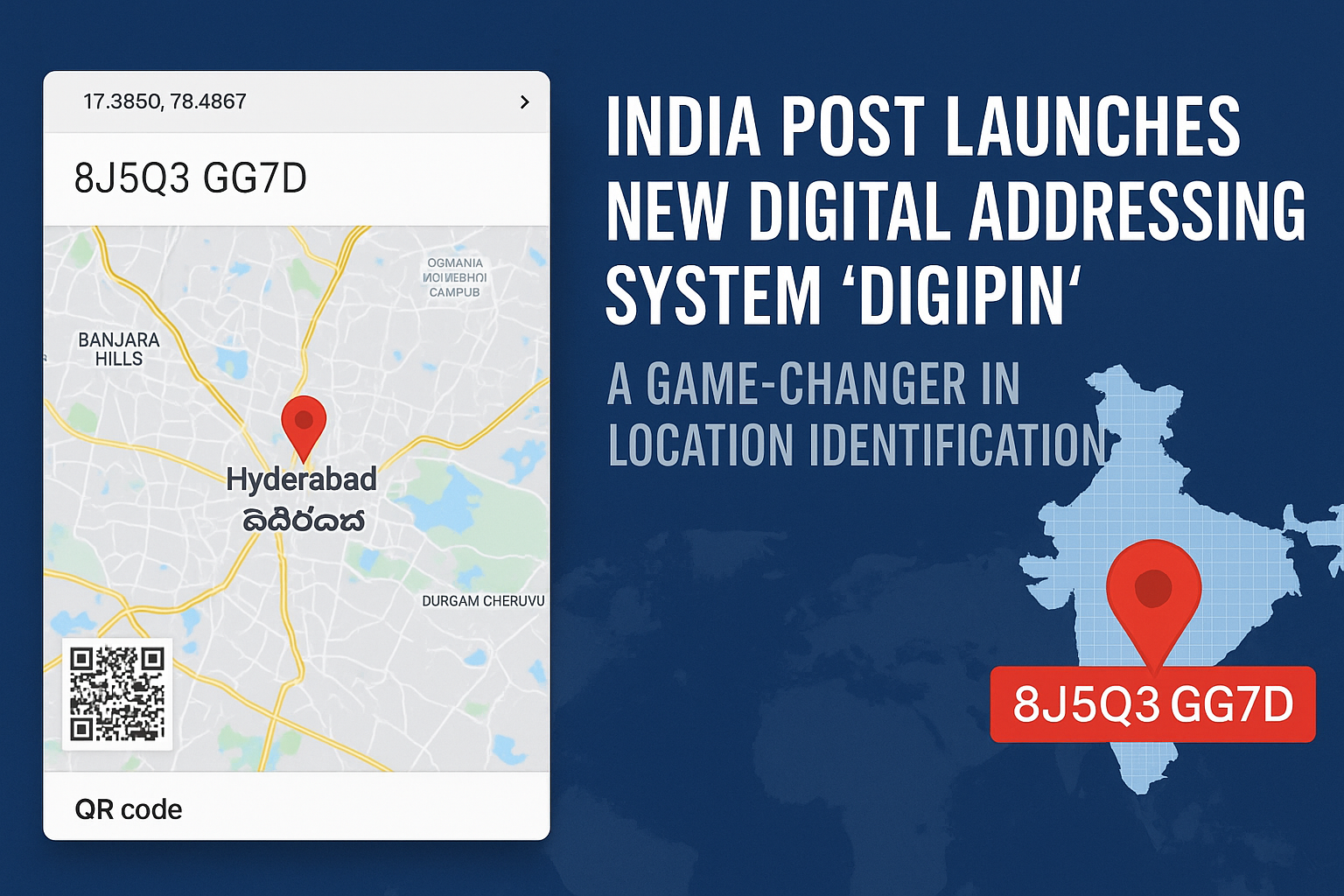
In a significant step toward transforming India’s geolocation system, India Post has introduced ‘DIGIPIN’—a 10-character digital address code system developed in collaboration with IIT Hyderabad, ISRO, and NRSC. The goal? To eliminate address ambiguity across the country by mapping every 4×4 metre area with a unique geospatial PIN.
To make this system accessible to the public, the website MyDigiPin has launched a free, interactive tool that allows users to find, decode, and share their DIGIPIN using live GPS, coordinates, or direct input.
🌐 What is DIGIPIN?
DIGIPIN stands for Digital PIN, a geo-referenced location code that acts as a precise digital identifier for homes, businesses, and public areas. It’s designed to work like an advanced version of traditional postal PIN codes but with pinpoint GPS-level accuracy.
Each DIGIPIN is a 10-character alphanumeric code that directly corresponds to a 4-meter square on the Earth’s surface. The system is based on a hierarchical spatial grid and uses internationally accepted coordinate formats (WGS84).
📱 How the MyDigiPin.com Tool Works
On the MyDigiPin website, users can:
-
📌 Find Your DIGIPIN Using GPS
Just click “Use My Location” to instantly generate your digital address. -
📍 Enter Coordinates to Get a DIGIPIN
Enter latitude and longitude to generate a code. -
🔍 Decode Any DIGIPIN
Want to know what location a code belongs to? Enter it to view on the map.
Each result shows:
-
The exact location on Google Maps.
-
Sharing and saving options.
-
QR code generation for offline use.
The tool is free to use, fast, and mobile-friendly.
🛠️ Why It Matters
The DIGIPIN system is designed to solve address mismatches, delivery delays, and public service inaccuracy. With India’s growing population and irregular urban expansion, traditional postal addresses often cause confusion. DIGIPIN can assist in:
-
Emergency response
-
Last-mile delivery
-
Public infrastructure planning
-
E-governance and digital services
-
Location tagging in rural and unaddressed areas
It also offers better privacy since no personal or house names are stored—just location grids.
🧪 Built With Scientific Precision
DIGIPIN was developed using spatial data science from IIT Hyderabad, NRSC, and ISRO, ensuring each 10-digit code has a unique place on India’s map. The grid spans longitudes 63.5°E to 99.5°E and latitudes 2.5°N to 38.5°N, covering India’s landmass and maritime zones.
The coordinate-based codes are created using a base-16 system (0–9 + A–F), offering directionality and scalability without needing an internet connection for decoding.
⚠️ Limitations and Scope for Improvement
While the tool is powerful, there are areas where improvements could enhance user experience:
-
Visual map previews are limited and sometimes slow to load.
-
No support for regional languages.
-
A lack of FAQs or help section for first-time users.
-
No official mobile app (yet).
However, as a first step toward digital address transformation, MyDigiPin’s site lays a strong foundation.
✅ Final Verdict
With India moving fast toward digital transformation, DIGIPIN is a promising innovation that could replace outdated and inconsistent address formats. MyDigiPin.com is currently the best public tool to explore this technology firsthand.
As government departments and businesses begin to adopt DIGIPIN into logistics and urban planning, this initiative may soon become a national standard.


